
These exclusive satellite images show Saudi Arabia’s sci-fi megacity is well underway

One of the main commercial uses for satellite imagery is to help companies understand how their rivals or entire countries are faring in the global marketplace—to see, for example, “how many cranes are active on the Manhattan skyline right now, or [how many] oil tankers are in port,” says Jamon Van Den Hoek, a geography professor and director of the Conflict Ecology Lab at Oregon State University.
“If there’s no Maxar images acquired over an area that is experiencing rapid economic investment, something fishy is going on,” Van Den Hoek says. “Probably the simplest solution is that a money interest is purchasing those images at the highest level, where they maintain an exclusive right to them.”
Not everyone agrees. “I’ve not heard of any commercial company trying to restrict things,” says Doug Specht, a geography lecturer at the University of Westminster in London. “My immediate reaction is that no one bothered with high resolution because it’s in the middle of a desert and high-resolution imagery is incredibly expensive to own and distribute.”
Stephen Wood, senior director of Maxar’s news bureau, told MIT Technology Review: “We do not have any recent high-resolution imagery that has been collected over these areas.” He wrote that the company primarily focuses on its customers’ areas of interest but “when we have available imaging time, we will collect other areas as part of our overall mission to continually update the entire globe with high-resolution imagery. We tend to concentrate first on those areas that exhibit the most change (e.g., cities, etc.) but will fill in those other areas of the globe as well.”
When asked if customers can obtain exclusive access to Maxar’s images, Wood replied: “The vast majority of everything we collect is placed into our public imagery archive which is a cornerstone of our imagery business. Those images are available for purchase and we ultimately serve our customers via a range of different contract types.”
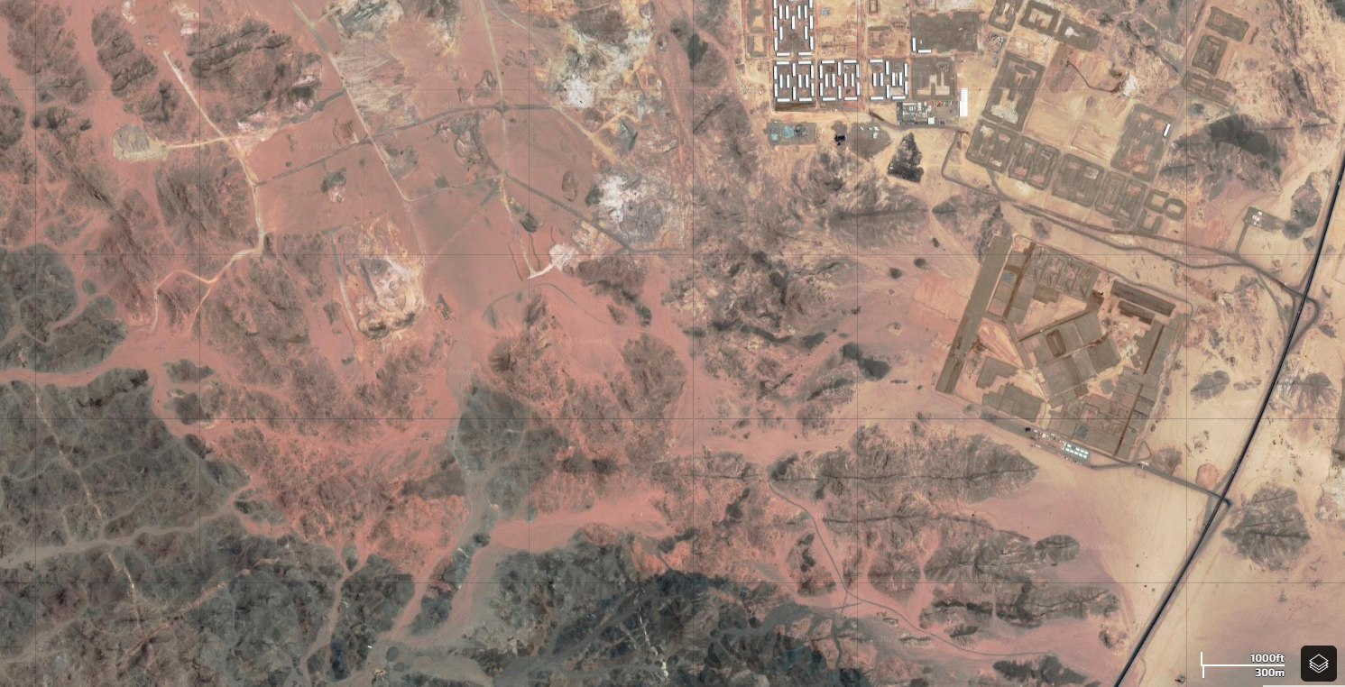
GOOGLE MAPS VIA SOAR
High-resolution Planet images of parts of The Line do seem to be available for licensing, although none have surfaced publicly on Google Maps to date.
A Google spokesperson told MIT Technology Review: “We are constantly updating satellite imagery as it becomes available from our imagery providers. Since our providers often focus on cities and places that are more heavily populated, these regions tend to get updated imagery more frequently.” The satellite images on Google Maps cover only about one-fifth of Earth’s surface—but 98% of its population.
While the entire surface of the planet gets photographed multiple times a day at low resolution, the sharpest images from the latest commercial satellites can still cost upwards of $3,000, according to a price list at Apollo Imaging, a satellite imagery aggregator. These are far from comprehensive, and some images are withheld from public access for national security reasons, a process known as shutter control. Many Chinese imaging companies, for example, will not sell any satellite pictures of China, North Korea, Taiwan, or Tibet.


